Geo - Reference Information Management
Geo - Reference Information Management
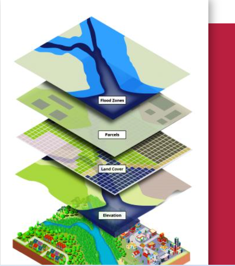
At Nielson, we offer cutting-edge Geo-Reference Information Management solutions tailored to meet the dynamic needs of modern industries. Our services integrate advanced geospatial technology with robust data management systems to deliver actionable insights that drive informed decision-making.
Key Features of Our Geo-Reference Information Management Services:
- Geospatial Data Collection and Analysis
- Accurate mapping and spatial data capture using state-of-the-art tools like GPS, GIS, and drones.
- Advanced data analysis to provide meaningful insights for urban planning, infrastructure development, and environmental management.
- Data Integration and Management
- Seamless integration of geospatial data with existing information systems for a holistic view of resources and assets.
- Secure storage and management of geospatial data to ensure accessibility and reliability.
- Custom Mapping and Visualization
- Development of high-quality maps and visual models tailored to your specific project requirements.
- 3D modeling and interactive mapping for better visualization and planning.
- Real-Time Monitoring and Reporting
- Deployment of solutions for real-time data monitoring, including environmental changes and asset tracking.
- Automated reporting systems for efficient project tracking and decision support.
Applications of Our Services
Our Geo-Reference Information Management solutions are invaluable across a variety of industries:
- Land Surveying and Urban Development: Precise land mapping for property boundaries, zoning, and city planning.
- Oil and Gas: Spatial analysis for pipeline routing, resource exploration, and site management.
- Construction and Infrastructure: Geospatial solutions for project planning, monitoring, and risk mitigation.
- Agriculture: Land-use planning, crop monitoring, and precision farming applications.
- Environmental Management: Tracking changes in ecosystems, managing natural resources, and disaster response planning.
- Expertise: Our team comprises skilled professionals with extensive experience in geospatial technologies
- Advanced Tools: We utilize the latest technology to ensure accurate, reliable, and efficient service delivery.
- Client-Centric Approach: We tailor our solutions to meet the unique needs of each client, ensuring maximum value.
VISION STATEMENT
We aspire to be among the leaders in Geo-referenced information services provider, with effective presence in Nigeria, West Africa and indeed Oil & Gas, Engineering and Building industry worldwide.
MISSION STATEMENT
We are a Customer-Oriented and Progressive Oil and Engineering Company. Our aim is to provide high quality professional service to our client irrespective of all constraints while maintaining efficiency and profitability.